Landmarks
Beautiful places near you
Kardzhali
City of Kardzhali is situated in the heart of the East Rhodope Mountains, on both banks of the Arda River, which is the largest river in the Rhodope Mountains. There are three of the largest dams in the country – Ia. Kardzhali, Studen Kladenets Reservoir and Ivaylovgrad Dam. Kardzhali is 259 km away. from Sofia and 100 km from Plovdiv. The town is 50 km away from the town of Haskovo and about 15 km from the ancient city of Perperikon. In the town of Kardzhali passes the Pan-European transport corridor №9 through the Makaza pass and the distance to the Republic of Greece is only 57 km. The climate in the area is continental-Mediterranean, mild and humid, with many sunny days a year.


Perperikon
“Perperikon is the largest megalith ensemble in the Balkans. It is thought that the famous sanctuary and oracular shrine dedicated to Sabazios (similar to Greek Dionysus) of the Bessi was situated there. The ancient Thracian city of Perperikon is located in the Eastern Rhodopes, 15 km northeast of the present-day town of Kardzhali, Bulgaria, on a 470 m high rocky hill, which is thought to have been a sacred place. Human activity in the area dates back to 5000 B.C. The first traces of civilization on the hill date from the Bronze Age, while the ceramics found on the place date from the Early Iron Age, as well as the impressive round altar, almost 2 m in diameter, hewn out of the rocks. The megalith complex had been laid in ruins and reerected many times in history.”


The Devil’s Bridge
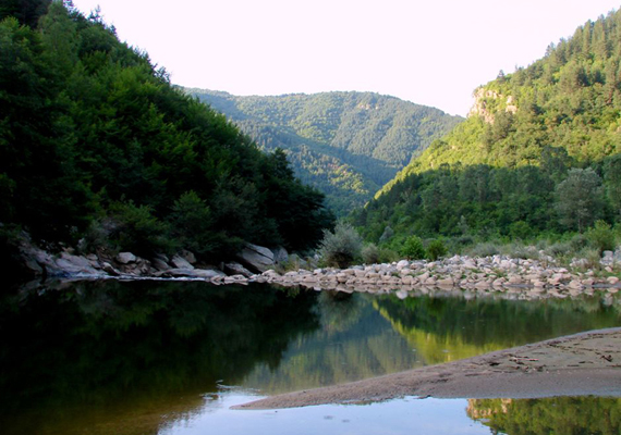
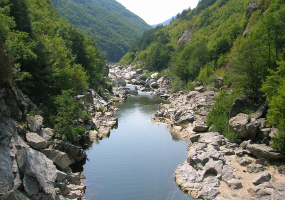
“Devil’s Bridge” is an arch bridge over the Arda River situated in a narrow gorge. It is located 10 km from the Bulgarian town of Ardino in the Rhodope Mountains and is part of the ancient road connecting the lowlands of Thrace with the north Aegean Sea coast. It is not certain when the Devil’s Bridge was built, with various sources stating from the 14th to the early 17th century. The bridge, the largest and best known of its kind in the Rhodopes, is 56 m long and has three arches, but also features holes with small semicircular arches to read water level. The Dyavolski most has a width of 3.5 m and its main arch is 11.50 m high. A stone parapet, 12 cm in height, is preserved on the sides, and breakwaters are placed opposite the stream.



Tatul
In the 2000s Bulgarian archaeologists discovered an ancient Thracian surface tomb and sanctuary in the immediate proximity of the village, and it was soon recognized as an exclusive religious centre in the region of importance to the whole region according to head archaeologist Nikolay Ovcharov. Latest archaeological finds date the earliest settlement to 4000 BC. The ancient sources describe the ritual of burying leaders overground, on the top of a hill (as opposed to in a mound), as extremely rare, mentioning only Orpheus and Rhesus as two of the leaders who were buried this way and as Orpheus was buried in Leibethra close to Olympus,Greece it only leaves Rhesus as a candidate though both of the characters are mythological and may have never existed. Christianization of the Rhodopes in the late 4th-early 5th century resulted in the conversion of the complex into a local ruler’s domain featuring a defensive tower. The complex also suffered from two earthquakes, once in the 12th century BC and once in the 14th century AD.


Utrobata Cave
Thracian sanctuary Utroba Cave dates back to XI – X century BC The temple is located near the village of Nenkovo in the Tangarak Kaya locality, about 20 km northwest of the town of Kardzhali. The cave is a natural horizontal crack in a rock that has been further cut and shaped by a human hand resembling a vulva. The height of the hole is 3 m, the width is 2.5 m and the depth is about 22 m. At the bottom of the cave there is a carved altar that is tall just over a meter. There is a crack in the upper part of the cave, where a sun beam enters for several minutes each day at 12 o’clock. On the day of the spring equinox, the sun’s beam is enlarged and enters the hole of the altar, holding it for several minutes. The action embodies fertilization, the sacred marriage between the rock and the Sun, the revival of life. Up to now, this is the only open cave in the world.


Petrified Wedding (the Stone Wedding)
“The natural landmark called The Petrified Wedding (the Stone Wedding) is located about 4 kilometers east of the town of Kardzhali, near the village of Zimzelen. Along with the stone mushrooms located near the village of Beli Plast, it is one of the most interesting rock formations of the so-called Kardzhali pyramids, located at the Kayadzhik and Chukata ridges in the eastern Rhodope mountain. The rock formations reach 10 meters in height and lie on an area of 50 dca. According to the scientific hypotheses the Petrified Wedding started forming 40 billion years ago, due to underwater volcanic activity, which formed the rock rhyolite tuffs. Later, after the sea receded, the rocks were exposed to rain, wind and sun, which formed them to their current shape. Various minerals in the rock are the reason for the diversity of colors and shades of the rocks. The name of the phenomenon was given due to the fact that the rock formations look like people, gathered at one place. According to the legend, a young man from the village of Zimzelen fell in love with a girl from a nearby village. During the wedding, on the travel to the village of Zimzelen, a strong wind blew off the veil of the bride. Her indescribable beauty made the guests speechless, and the father-in-law felt jealous of his son. The natural forces petrified everyone for the impure thoughts of the father-in-law. Only the groom lived, crying bitter tears, begging the wind to petrify him too. The elements fulfilled his request and the phenomenon The Petrified Wedding stands to the present day near a puddle, which is believed to be made of the tears of the unfortunate groom.”


The stone mushrooms
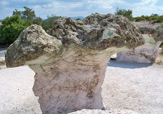
“The stone mushrooms are rock formations, located east of the village of Beli Plast, at the road, connecting Kardzhali with Haskovo. The protected site has a total area of 3 hectares. It was declared a natural landmark by Order No 1427 of 13 May 1974. The rock formations have the shape of natural mushrooms – their stalks are pink, and the caps are green. The height of the mushroom stalks and the width of the caps are up to 2.5 meters. They are made of rhyolite volcanic tuffs, which are the result of intensive underwater volcanic activity, dating back to the Paleocene. After the sea withdrawal and the consistent seabed rising, the influence of the erosion became visible. The lower, pink layer proved to be softer and more amenable to the effects of sun, wind and rain. The upper, green layer contains solid minerals, mainly volcanic glass and it is therefore more difficult to weather. So a wonderful combination of unique shapes and colors has formed over the millennia. According to a legend, the charcoal burner Raduil lived in the Perperikon fortress with his four beautiful daughters. One sunny morning they went outside the town walls to bring water. Suddenly, they saw a great horde of invaders at the hill near the river. They ran back to the fortress. A fervent, uneven battle started; many men were killed, most of the women were captured. The daughters of Raduil were among them. They were waged to the leader of the horde, astride a racial horse at the nearby river – to take a look at them and choose the most beautiful ones for him and to sell the others as slaves. Fury gripped the hearts of the girls as they approached him. They grabbed what they could – sticks, stones, and began throwing them at the rider. The horse got scared and stood on its hind legs. The unsuspecting rider fell on the ground, the four girls ran towards him and tore him apart and ran into the forest. The closest friend of the leader ran to pursue the girls and caught them at the end of the day, lashed out with his yataghan and cut off the first one’s head. As it fell on the ground, it turned into a stone mushroom. The same happened with the other sisters. Before the man cut the head of the last girl, she petrified. The terrified man tried to escape with his horse, but turned into a black rock at the first step. Nowadays people call the lonely rock near the mushrooms Karatepe.”



The Eagle Rocks
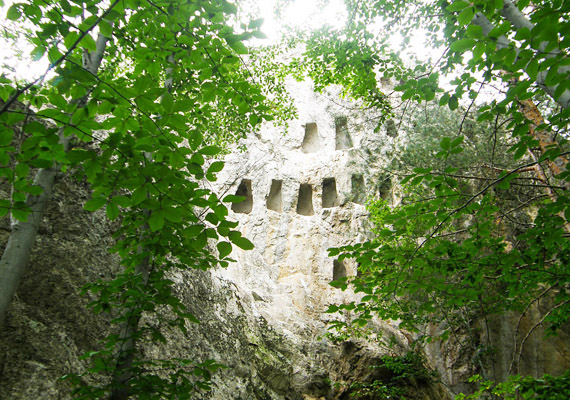
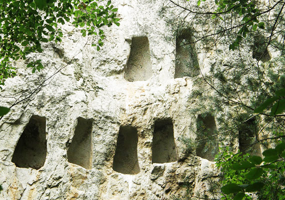
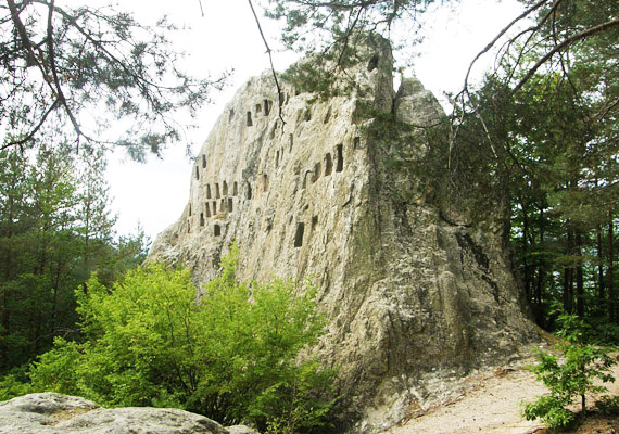
The Eagle Rocks represent a Thracian sanctuary located about 2 km from the town of Ardino and around 30 km southwest of the town of Kardzhali. This Thracian ancient cultural site is unique for the country. The height of the rock is uneven and steep in all directions. There were more than 100 hand cut niches in the rocks at inaccessible places with three lost to erosion and 97 remaining. The 8 and 12 cm deep trapezoidal niches were probably used in the cult of the deceased.

St. John the Precursor’s church in Kardzhali
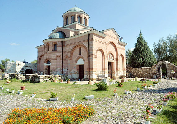
“This is a fortified monastery at the right bank of Arda river. Its building starred in the IX century and it was reorganized in the XI century. They built a fortress wall with square towers in the corners and in the middle of each wall and the temple started functioning as a bishop’s residence. There are wall-paintings preserved, dating from the XIII century. During their studies in 1998, archaeologists found unique gold-threaded garment, which belonged to one of the bishops of Achridos. The ceremonial robes – made of silk, embroidered with gold threads – have been carefully preserved. A wonderful image of the Mother of God with a Greek inscription has survived on the lower portion of one side. The temple has its contemporary appearance since the year of 2000. In the town suburbs, at the left side of the road to Petlino village there is a well-preserved Roman barrow. During the archaeological works there appeared many graves, situated near the barrow’s edge, with grave inventory. The items are stored in the regional museum of history.”


Historical Museum of Kardzhali
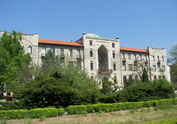
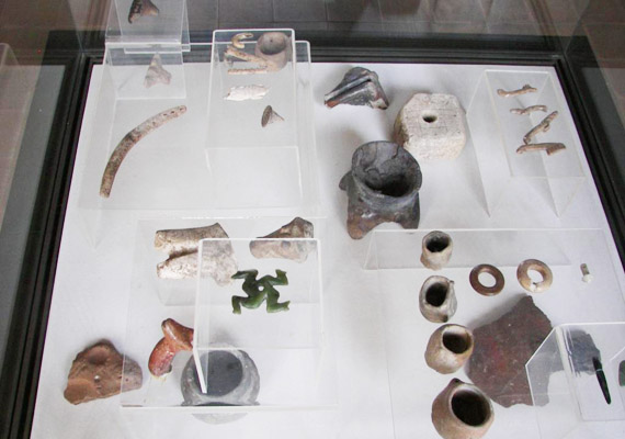
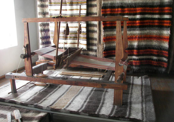
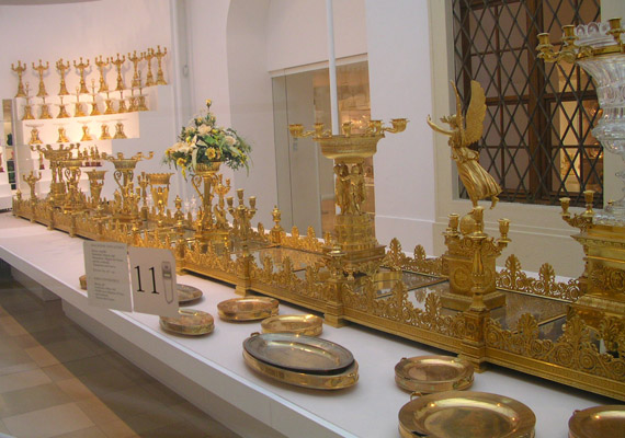
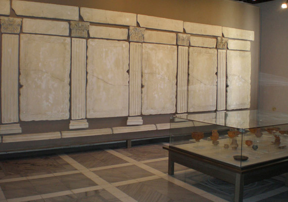
The Regional History Museum in Kardzhali existed since 1963. It is located in an ancient three-storey building, an architectural monument of culture built in the early 1920s. In the early 1980s, the building was adapted for museum purposes by architect Elena Condeva. The museum contains more than 45,000 exhibits tracing the life of the Eastern Rhodopes from the deepest antiquity to the beginning of the 20th century, collected in three collections, thematic detached in the departments “Archeology”, “Nature”, “Ethnography”. The Stana Dimitrova Art Gallery, which is housed in the building of a former Konak, also operates the regional museum.
Our rooms
Browse and choose the most suitable for you
Address
Behi Boutique Hotel
12 Georgi Kondolov Street
6600 Kardzhali
BulgariaReservations
Tel.: +359 (0)361 88 2 88
Fax: +359 (0)361 88 2 88
hotelbehi@firma-behi.comApplication
Methods of payment


